USDA partnered with the Kirby Creek Coordinated Resource Management (CRM) Group to help maintain and enhance the quality of the Kirby Creek Watershed in Wyoming.
Looking out over a scenic Wyoming landscape, one might realize the beauty and life-sustaining resources nature created along the Kirby Creek Watershed. However, hidden among the splendor lies dangers to humans. But, these hazards aren’t immediately visible to the naked eye.
In 2000, a conservation group began to examine the watershed located in the northwest part of the state near the Bighorn Basin. After a water test confirmed the creek was contaminated with high levels of E. coli, the group determined the threat was caused by cattle using the creek as a water source.
The Kirby Creek Coordinated Resource Management (CRM) Group then began to focus on improving the water quality. Kirby Creek Watershed was already known for its landscape, crystal-clear water and mountain views, so maintaining the water’s quality was significant.
Involved in the effort were local ranchers and landowners, the Bureau of Land Management, Hot Springs Conservation District, Wyoming Game and Fish Department, the Wyoming Department of Agriculture and USDA.
“Our mission from day one continues to be to assess, maintain and enhance the quality of the Kirby Creek Watershed through a cooperative process while protecting the quality of life, custom and culture, and the economic base of the community,” said Larry Bentley, CRM Coordinator for the Wyoming Department of Agriculture. “Everything we do is targeted toward stabilizing soils, increasing vegetative production and maintaining water quality.”
The USDA Farm Service Agency’s (FSA) Conservation Reserve Program (CRP) plays an important role in the group’s success. CRP, which is celebrating its 30th anniversary in 2015, is among the largest private lands program for conservation used extensively throughout the United States to reduce soil erosion, improve water and air quality and provide wildlife habitat.
CRP is a voluntary program that allows eligible landowners to receive annual rental payments and cost-share assistance to establish long-term, resource-conserving covers on eligible farmland throughout the duration of their 10- to15-year contracts.
Under the program, farmers and ranchers plant grasses and trees in fields and along streams or rivers. The plantings prevent soil and nutrients from washing into waterways, reduce soil erosion that may otherwise contribute to poor air and water quality, and provide valuable habitat for wildlife.
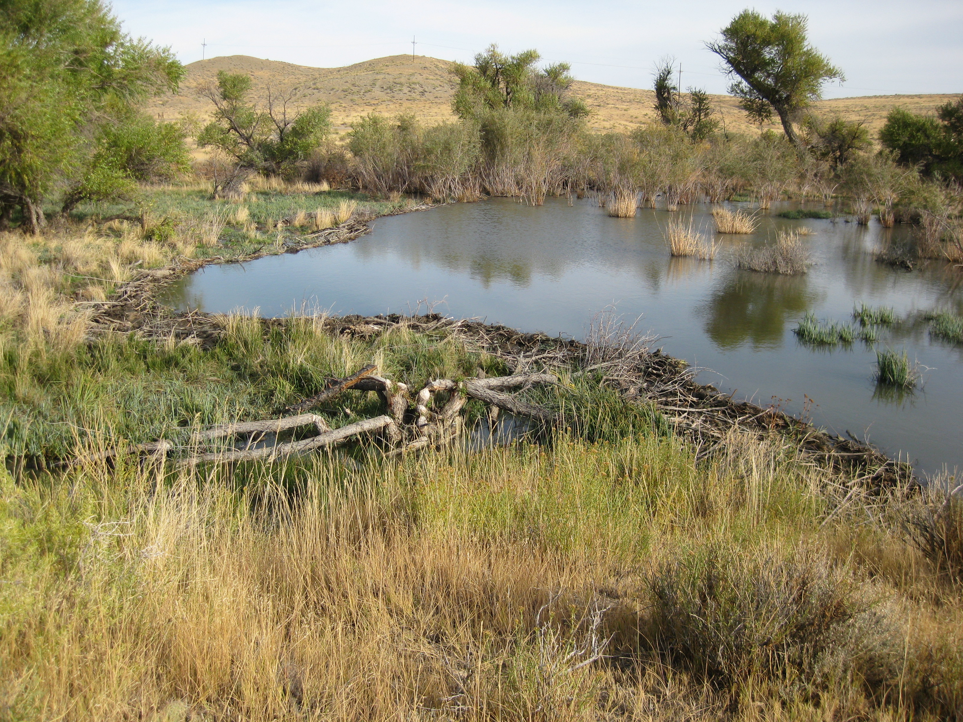
Today, CRM maintains and enhances the quality of the Kirby Creek Watershed that covers approximately 200 square miles and 128,000 acres. CRP is one of the tools contributing to CRM’s success.
Around 360 acres along Kirby Creek are currently enrolled in CRP to help with stream bank restoration. With the help of CRP, landowners have also received assistance for installing grass buffers along with fencing, off-site water development, historic channel restoration and weed control.
These projects have prevented livestock from accessing the stream banks and water, which in turn has improved sage grouse and riparian habitat, increased the number of cottonwoods and willows and improved beaver activity along the creek.
In 2012, The Bureau of Land Management, an agency with the U.S. Department of the Interior, selected Kirby Creek Coordinated Management as the winner of the Rangeland Stewardship Award.
Terry Wilson, a landowner and member of the CRM, has used CRP to improve the water and resources on her land.
“I used CRP on my land to fence livestock off from the river and to develop alternate water sources by installing pipeline and water caps,” said Wilson. “The program has also helped me put in reservoirs, develop streams and spray sage brush.”
Since being established on Dec. 23, 1985, CRP has helped prevent more than 9 billion tons of soil from eroding and protected more than 170,000 stream miles with riparian and grass buffers, more than 100,000 acres of bottomland hardwood trees, nearly 300,000 acres of flood-plain wetlands, and 250,000 acres each for duck nesting habitat and upland bird habitat.
For an interactive tour of CRP success stories from across the U.S., please visit the FSA CRP 30th Anniversary website at http://www.fsa.usda.gov/CRPis30.


