No-till Farming, Wildlife Conservation, Ideal in Nebraska

NE_Gillespie Photo 040715 2

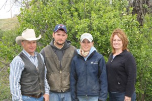
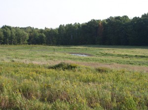
After participating in a conservation program for seven years that focuses on enhancing wildlife habitat, Nebraska farmer Leon “Bud” Gillespie, has created more wildlife habitat and resources while limiting erosion on his land. Pictured from left to right: Leon “Bud” Gillespie and Larry Steinbrecher, Morrill County FSA Executive Director.

Lifelong farmer, Leon “Bud” Gillespie, knows the importance of caring for the land to ensure it remains healthy and productive for future generations. He has seen firsthand how cropping environmentally sensitive land can affect the soil and environment in Morrill County, Nebraska.

“As land in this area was being settled in the late 1800s and early 1900s anything that looked like it could be farmed was broken out and planted to crops,” said Gillespie. “It was soon evident that much of this land should have been left as native grassland. The shallow soils and uneven terrain did not produce well and were subject to wind and water erosion.” Continue reading

Posted in Atop the Fence Post, CRP is 30, Features, Regional Posts | 2 Comments

Mapping the Ag-Nation: GIS Impacts FSA Farm Bill Planning

Following the passage of the Agricultural Act of 2014, better known as the 2014 Farm Bill, the USDA Farm Service Agency (FSA) drafted a plan to educate producers on the new programs and regulations. Nationwide, FSA participated in nearly 5,000 educational workshops and meetings.

As county offices hosted educational workshops, state offices were tasked with recording outreach efforts to report to the FSA National Office. Using spreadsheets is common for reporting purposes, but Dan Janes, North Dakota GIS Specialist, took it a step further using Geographic Information Systems (GIS). Continue reading

Posted in Atop the Fence Post, Features, Regional Posts | Comments Off on Mapping the Ag-Nation: GIS Impacts FSA Farm Bill Planning

Idaho Century Farm Recognized for Outstanding Conservation Practices

ID_Finished wildlife trough at Curl place 2008.

After 28 years of implementing conservation practices, the Farwell family has watched their marginal farmland transition into a cover of native and improved grasses that has reduced soil erosion and increased wildlife habitat.

As teenage boys Gary Farwell and his brothers Mike and Douglas jumped at the chance to help in the wheat and barley fields on their Idaho farm. As much as the family enjoyed farming and the agricultural way of life, Gary’s father and uncles, Max and William Farwell, were well aware of the challenges of consistently raising a crop on the marginal land which led them to enroll most of the family farm into the USDA Farm Service Agency (FSA) Conservation Reserve Program (CRP) 28 years ago.

“In the early years of our CRP enrollment it seemed like our values as farmers were up-ended,” said Farwell. “The beautiful green and golden colors of the summer crops were replaced by grass, shrubs, brush and weeds.” Continue reading

Posted in Atop the Fence Post, CRP is 30, Features, Regional Posts | 2 Comments

Mapping the Ag-Nation: GIS and Imagery Helps when Disaster Strikes Texas

Pivot

Pivot used for agricultural irrigation, previously surrounded by waist-high corn buried under sediment deposited by flood waters. Courtesy of USDA Farm Service Agency

USDA’s Farm Service Agency (FSA) is using Geographic Information System (GIS) technology to facilitate the damage assessment process after flooding in Texas. Farm and ranchland in Bowie County, Texas, along the Red River was submerged underwater for most of the month of June following torrential rains in Texas and Oklahoma.  In addition to the rainfall, Bowie County experienced significant flooding as a result of water let out from Lake Texoma, one of the nation’s largest reservoirs. Continue reading

Posted in Atop the Fence Post, Features, Regional Posts | 1 Comment

USDA and Partners Bring Bobwhite Quail Back to Ohio’s Highland County

DSC_0027

David Roehm is doing his part to bring Bobwhite quail back to Highland County, Ohio, by using the Conservation Reserve Program (CRP) to provide upland bird habitat buffers.

The Bobwhite quail has re-established its home in Ohio, and many say the reason for the return is a critical conservation effort.

Nearly 15,000 acres in southern Ohio’s Highland County are enrolled in the Conservation Reserve Program (CRP) administered by USDA’s Farm Service Agency (FSA). That’s the second largest county total in the state.

Many of the CRP practices in Highland County focus on creating Bobwhite quail habitat thanks to a partnership among Pheasants Forever, Quail Forever, U.S Fish and Wildlife Service, Ohio Division of Wildlife and USDA. Local landowners are active participants and gain significant benefits through their role.

The partnership was formed seven years ago when a natural resources professor at The Ohio State University challenged three research students to start a project to help re-establish Bobwhite quail populations in the county.

Barb Bauer, wildlife biologist with Pheasants and Quail Forever, says the high number of CRP acres in Highland County is one of the main reasons Bobwhite quail have survived.

The partners, with the help of CRP, provide financial assistance to landowners to help establish edge feathering alongside of woods, which provides a gradual transition from cropland to grasses, trees and shrubs that provide adequate cover for wildlife. The partners also offered free use of seeding drills to establish the right forbs habitat.

CRP, which is celebrating its 30th anniversary in 2015, is among the largest private lands program for conservation used extensively throughout the United States to reduce soil erosion, improve water and air quality and provide wildlife habitat.

It is a voluntary program that allows eligible landowners to receive annual rental payments and cost-share assistance to establish long-term, resource-conserving covers on eligible farmland throughout the duration of their 10-to-15-year contracts.

“Highland County has a long history of CRP involvement and we saw this project as a way to maximize the impact and benefits of CRP that address water and air quality, soil erosion and wildlife habitats,” said Jim Patton, USDA Farm Service Agency County Executive Director in Highland County.

During the first year, conservation partners started to extend habitats 30 feet from the edge of woodland areas.  The student researchers did a Bobwhite quail study and thesis. Their goal was to check on local populations and identify ways to increase bird numbers.

Studies showed that a lack of grass and forbs was a limiting factor in the landscape for Bobwhite quail populations. The birds lacked ideal habitat.

The students worked with David Roehm, a landowner near Leesburg. About 40 acres of Roehm’s farm near the Fallsville Wildlife Area are enrolled in CRP. Warm-season grasses and filter strips were planted with better wildlife cover. Grass waterways were developed, too. Roehm also established edge feathering for Bobwhite quail winter cover.

“I have learned so much about my farm through the work of the graduate students and the many other partners,” said Roehm. “While we have not seen large gains in Bobwhite quail populations yet, we continue to work on the right ideas. I am seeing wildlife, such as wild turkeys, that I did not see before, so I know we are making progress.”

This spring Roehm planted additional upland bird habitat buffers in forbs and plant species next to edge-feathered sites to help enhance the habitats.

“I recommend others establish or re-establish conservation on their farm,” said Roehm. “Conservation efforts do not have to be at odds with production agriculture. It is possible to support agriculture and benefit the environment.”

Bobwhite quail populations are an indicator species of the ecosystem and food chain.

“As we lose population that indicates a breakdown of our ecosystems,” said Bauer. “Upland bird habitat buffers provide good habitat for Bobwhite quail brood rearing, and by establishing this ecosystem we help other ecosystems such as pollinator feeding habitats for the declining bee species.”

Since being established on December 23, 1985, CRP has helped prevent more than 8 billion tons of soil from eroding and protected more than 170,000 stream miles with riparian and grass buffers, more than 100,000 acres of bottomland hardwood trees, nearly 300,000 acres of flood-plain wetlands, and 250,000 acres each for duck nesting habitat and upland bird habitat.

2015 marks the 30th Anniversary of CRP. For an interactive tour of CRP success stories from across the U.S., please visit the FSA CRP 30th Anniversary website at http://www.fsa.usda.gov/CRPis30.

Posted in Atop the Fence Post, CRP is 30, Features, Regional Posts | 1 Comment

Mapping the Ag-Nation: Exploring FSA GIS – An Introduction

A map allows information based on location, such as an address, to be represented graphically. It allows a person to paint a picture for the viewers of the information so they can see the geographic location of particular features. It does other things as well, like generate an historic image of the way things were on a specific date.

As maps relate to actual geographic conditions, they are useful tools, but maps on their own do not lend easily to making decisions or finding solutions to geospatial problems, such as flood vulnerabilities or boundary disputes. Instead of trying to identify connections between data charted on multiple layers of physical map overlays, a tactic used in the past to find solutions to complex spatial problems, USDA’s Farm Service Agency (FSA) turns to Geographic Information Systems (GIS).

GIS describes any automated system for spatially managing and analyzing geographic information that can be tied to a place on the ground. This system, largely developed through the work of Roger Tomlinson in 1962, provides the ability to compile and analyze multiple layers of data simultaneously. It has shaped how FSA produces maps. Essentially, GIS allows an FSA agricultural map to quickly go from this 1983 FSA Farmland map of Rockingham County, Virginia, with hand-drawn field boundaries and labels that would have taken a few days to draw:

COMBINED

The various programs offered by FSA help agricultural producers across the Continental United States, Hawaii and Alaska, and United States territories, including American Samoa, Guam, Puerto Rico, the Virgin Islands and the Northern Mariana Islands, purchase and operate farms, stabilize farm income, conserve land and water and recover from the effects of disasters.

In order to determine the benefits producers will receive for their participation in FSA programs, FSA must know the specific crop acreage or other land use information. GIS helps FSA staff efficiently measure land features by allowing computer-generated maps to interact with databases that store information about the land, known as attribute data.

GIS technology provides FSA county office employees the tools to help producers exercise good land stewardship, provide more accurate information needed for quick decision-making in the face of disasters or emergencies and reduces the amount of time a producer spends working with local FSA staff in order to participate in USDA programs. GIS helps farmers spend less time in the office and more time in the field.

There are many stories that show how GIS has streamlined FSA operations in the office and on the farm – impacting procedures for conservation and disaster management, providing opportunities for special projects in FSA state offices and bridging communication between FSA and producers the agency serves.

This introduction to GIS is the first in a series of articles that will focus on how GIS is used to improve business operations in the office and in the field throughout FSA.

For questions regarding GIS, please contact Shirley Hall, FSA GIS Program Manager.

Posted in Atop the Fence Post, Features, Regional Posts | 2 Comments

Iowa Rediscovers Wetlands

Photo with sign

A conservation partnership utilizing a Farm Service Agency conservation program has allowed Iowa landowners to restore 72 shallow wetlands to improve surface water, increase wildlife habitat and provide recreational opportunities.

Conservation Program Restores Areas and Regains Environmental Benefits

Iowa is considered one of the most ecologically altered states in the nation. The Iowa Department of Natural Resources reports that about 10 percent of the state’s surface area was once comprised of wetlands, but that changed. Nearly 95 percent of the wetland basins were drained resulting in a loss of ecological benefits. Continue reading

Posted in Atop the Fence Post, CRP is 30, Features, Regional Posts | Comments Off on Iowa Rediscovers Wetlands

Conservation Plays Key Role in Preserving Oklahoma Centennial Farm

Dan OHair 1

Dan O’Hair, a fifth generation farmer and rancher in Oklahoma followed in his father’s footsteps by preserving the land using conservation programs.

Dan O’Hair is a fifth generation farmer/rancher who lives on a Centennial Farm in the far southeast corner of “No Man’s Land” in Oklahoma. In 1901, his great grandfather and grandfather each staked claim to 160 acres through the Homestead Act. His parents remained on the farm throughout the 1930s depression and Dust Bowl Era. The endurance and persistence of his father led to a significant increase of farm acreage.

“Although the Dust Bowl was tough, there was rainfall and crops were raised on their farm,” said O’Hair. Continue reading

Posted in Atop the Fence Post, CRP is 30, Features, Regional Posts | 1 Comment

Minnesota Landowner Commits to Conservation to Preserve Land for the Next Generation

HillSkyChainofLakes

Minnesota Farmer, Carl “Russ” Pilegarrd, has participated in the Conservation Reserve Program from the start. He uses wetland buffers and shelter belts to prevent erosion, improve soil and water quality and promote wildlife habitat.

When the USDA Conservation Reserve Program (CRP) was enacted in December of 1985, Carl “Russ” Pilegaard, a Minnesota farmer knew the program was something he needed to incorporate into his farming operation so he reached out to his local Farm Service Agency (FSA) office.

Pilegaard was one of the first farmers in Minnesota to participate in CRP when, in 1986, he enrolled 108 acres of his farm near Ruthton in Murray County into the program. Continue reading

Posted in Atop the Fence Post, CRP is 30, Features, Regional Posts | Comments Off on Minnesota Landowner Commits to Conservation to Preserve Land for the Next Generation

USDA Marks 10th Year of Conservation Partnership in Oregon; 30th Anniversary of Conservation Reserve Program

IMG_8469

USDA, conservation partners and landowners worked together to protect the Tualatin River Watershed by restoring fish habitat and cooling the stream.

Farmers and ranchers in Oregon have more than the 30th anniversary of USDA’s Conservation Reserve Program (CRP) to celebrate in 2015. The Farm Service Agency (FSA) state staff can also boast about a 10-year partnership that made the Conservation Reserve Enhancement Program (CREP) available to Oregon producers to protect the Tualatin River Watershed.

The local CREP concept all started during a gathering at Ralph Duyck’s farm near Forest Grove in 2005 when a group of conservation enthusiasts came together with the goal of protecting water quality and fish and wildlife habitat. Continue reading

Posted in Atop the Fence Post, CRP is 30, Features, Regional Posts | Comments Off on USDA Marks 10th Year of Conservation Partnership in Oregon; 30th Anniversary of Conservation Reserve Program